

MARTAC Launches their MANTAS Unmanned Surface Vehicle Mobile Inspection Solution
- October 20, 2017
October 2017 – KeoKuk, IA |

Partnering with Ameren, the MANTAS USV Mobile Inspection Platform Successfully Inspected the Keokuk Renewable Energy Center and Dam in Keokuk, IA on the Mississippi River.
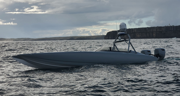
On 10/20/17, MARTAC, an innovator in unmanned maritime systems, along with Ameren successfully completed an unmanned hydrographic survey of the Keokuk Energy Center and Dam located on the Mississippi River. With this successful hydrographic survey, MARTAC Commercial is announcing the launch of the MANTAS USV Mobile Inspection Solution for customers who want a safer, highly accurate, and cost-effective means to perform subsurface inspections of their dams, bridges, harbors, pipelines or other maritime structures. Of the company’s recent unmanned hydrographic survey, MARTAC’s CEO Bruce Hanson said, “The completion of this survey represents a milestone for unmanned maritime systems with results far surpassing what we expected. We successfully navigated the Mississippi River and performed multibeam sonar scans of the dam, powerhouse, ice break and bay – all areas where either divers or manned hydrographic surveyors would have been at risk. We are excited to offer this new capability to the maritime inspection market”.
Ameren recognized the opportunity that the MANTAS USV Mobile Inspection Solution generates more accurate surveys of the Keokuk Dam when compared to their past use of divers or manned survey vessels. This is possible because the MANTAS USV Mobile Inspection Solution combines a superior unmanned platform MANTAS with Teledyne Reson’s T20 High Resolution Multibeam Echosounder to get extremely accurate views of the dam, river bed, ice break and powerhouse. The maneuverability and speed of the MANTAS unmanned system, along with the easy-to-use TASKER control system allowed users, through MANTAS, to get close to these areas and perform scans in challenging environments. These environments contained currents as high as 12 knots along with violent changes in direction and turbulence around the powerhouse. All of this hydrography was performed in a fraction of time it would take divers to perform surveys while not interfering with dam operations or forcing down time in power generation.
Scan results showed a high level of accuracy in mapping the structures. Todd Meyer, Consulting Engineer for Ameren Missouri, said “Ameren has found a valuable tool in our subsurface inspection plans. The survey images and bathymetric maps allow us to view the dam and structures as if we were in the water next to them. It also allows us to meet our reporting requirements and address our improvement projects with more accurate information. We will continue to utilize the MANTAS USV Mobile Inspection Solution to survey and develop bathymetric maps of our subsurface assets.”
The names of actual companies and products mentioned herein may be the trademarks of their respective owners.